Hiking & Trekking in Ninh Thuan: Best Trails and Routes
Ninh Thuan's dry forests, coastal cliffs, and highland valleys offer unique trekking. Here are the best hikes for all levels.
Why Trek in Ninh Thuan?
Ninh Thuan isn't a trekking destination in the traditional sense — no multi-day mountain expeditions or established trail networks. What it offers is unique: coastal cliff walks, dry forest exploration, and highland valley routes that see almost no tourists.
If you're tired of crowded trails in Sapa or Da Lat, Ninh Thuan provides solitude, unusual ecosystems, and landscapes that don't look like the rest of Vietnam.
Start with the Nui Chua National Park guide if you need an overview of permits, ecosystems, and access before choosing a trail.
Best Treks by Difficulty
Easy: Mui Dinh Lighthouse Trail
Location: 15km north of Ca Na
Distance: 2km round trip
Time: 1-1.5 hours
Difficulty: Easy. Clear path, moderate incline.
What you see:
- Coastal cliffs with 360° ocean views
- French colonial lighthouse (still operational)
- Rocky headland geology
- Possible whale watching (February-April)
Best time: Early morning (6-8am) for sunrise, or late afternoon (4-5pm) for softer light.
Access: Drive to the lighthouse base parking area. Trail starts there.
Who it's for: Anyone with basic fitness. Good for families with older kids (8+).
See the dedicated Mui Dinh Lighthouse guide for access notes and how to combine the walk with the southern coast.
Moderate: Hang Rai Coastal Trek (Nui Chua National Park)
Location: Eastern coast of Nui Chua, accessed via ranger station
Distance: 10km round trip (5km each way)
Time: 5-6 hours total (including beach time)
Difficulty: Moderate. Rocky, uneven terrain. Some sun exposure.
What you see:
- Dry dipterocarp forest (rare ecosystem)
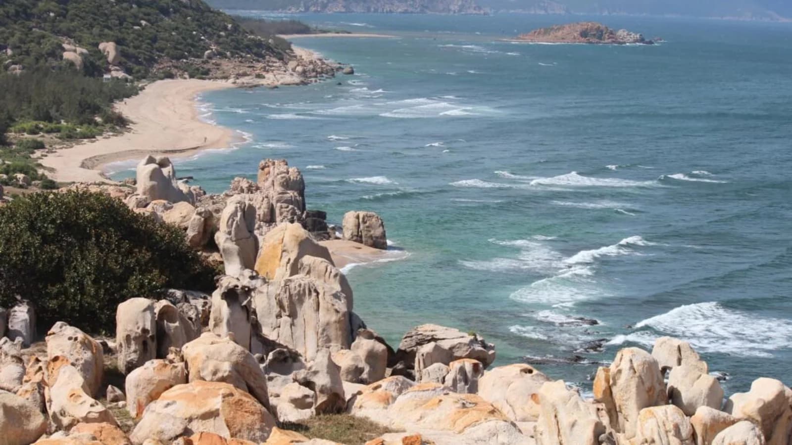
- Coastal cliffs and sea views
- Hang Rai beach (coral rock formations, sea turtle nesting site)
- Wildlife: Monkeys, monitor lizards, birds
Requirements:
- Must book ranger guide (300-500k VND for group up to 5 people)
- Book 1-2 days ahead at Nui Chua ranger station
- Guide is mandatory for conservation and safety
What to bring:
- 2L water/person (no water sources on trail)
- Snacks/lunch
- Hiking shoes (not sandals — sharp coral rocks)
- Hat, sunscreen
- Reef shoes if you plan to swim at Hang Rai
Best time: March-August (dry season). Avoid September-December (muddy, slippery).
Who it's for: Hikers comfortable with rocky terrain and hot conditions. Not suitable for young children or people with mobility issues.
Moderate-Hard: Nui Chua Peak Trek
Location: Nui Chua National Park
Distance: Variable (8-15km depending on route)
Time: Full day (6-8 hours)
Difficulty: Moderate to hard. Steep sections, rocky terrain, exposed ridges.
What you see:
- Summit views over coast and inland valleys
- Diverse forest types (dry lowland to montane forest)
- Wildlife (best chance to see endemic species)
- Remote, rarely visited trails
Requirements:
- Ranger guide mandatory (500k-1M VND depending on route)
- Good fitness required
- Book several days ahead
What to bring:
- 3L water/person
- Full lunch and snacks
- Proper hiking boots
- Sun protection
- First aid kit
Best time: November-April (cooler temperatures, dry trails)
Who it's for: Experienced hikers seeking challenge and solitude.
Easy-Moderate: Song Pha Valley Walk
Location: 40km inland from Phan Rang (highland area)
Distance: Flexible (2-10km depending on route)
Time: Half-day to full day
Difficulty: Easy to moderate. Rolling hills, some steep sections.
What you see:
- Highland valley landscapes (cooler than coast)
- Raglai minority villages
- Sakai waterfall (seasonal — best May-October)
- Agricultural terraces
Access: Self-guided or hire local guide through homestays (~200-300k).
What to bring:
- Water
- Snacks
- Camera (photogenic valley views)
- Cash for buying local fruit/crafts in villages
Best time: Year-round, but waterfall only runs May-October.
Who it's for: Casual hikers, photographers, cultural travelers.
Day Hikes from Phan Rang
If you're based in Phan Rang and want short hikes without overnight trips:
1. Nam Cuong Sand Dunes
Distance: Near Phan Rang
Hike: 2-3km walking on dunes
Time: 1-2 hours (late afternoon recommended)
Difficulty: Easy. Soft sand (tiring but not technical).
What you see: Sand dunes, late light, and local activity if you arrive at the right time.
Best for: Sunrise photography, sandboarding.
2. Po Klong Garai Hill Walk
Distance: 7km from Phan Rang
Hike: Short 500m walk up to tower complex
Time: 30 minutes
Difficulty: Easy. Paved path.
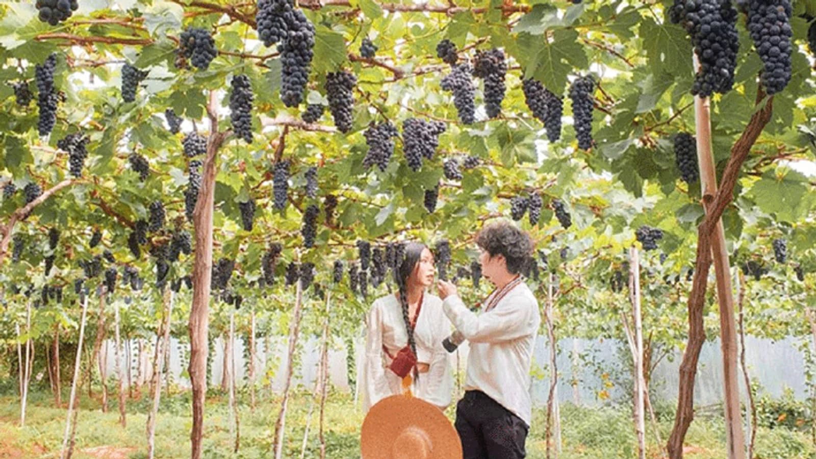
What you see: Cham towers, panoramic views of vineyards and dry landscape.
Best for: Culture + light exercise combo.
Wildlife & Nature
What You Might See
Nui Chua National Park:
- Long-tailed macaques (common)
- Water monitor lizards (common near coast)
- Endemic bird species (check eBird for recent sightings)
- Sea turtles (Hang Rai beach, May-August nesting season)
Song Pha Valley:
- Agricultural birds
- Occasional wild boar (rare, usually avoid humans)
- Snakes (mostly harmless, but watch your step)
What You Won't See
Ninh Thuan doesn't have large mammals. No elephants, bears, or big cats. The dry climate limits biodiversity compared to wetter regions.
Safety & Preparation
Heat Management
Ninh Thuan is HOT. Midday temperatures regularly hit 35-38°C.
Strategy:
- Start hikes early (6-7am departure)
- Finish by noon
- If hiking afternoon, start at 3-4pm and finish before dark
- Bring more water than you think you need
- Wear lightweight, breathable clothing
Trail Conditions
Dry season (Nov-Aug): Trails are dusty but stable. Good traction.
Wet season (Sep-Oct): Some trails become muddy and slippery. Coral rock areas get dangerously slick.
Navigation
No marked trails in most areas. GPS tracks and guides are essential for anything beyond obvious paths like Mui Dinh.
Download offline maps (Maps.me, Gaia GPS) before you go. Cell signal is weak in Nui Chua and Song Pha.
Emergencies
Nui Chua ranger station: Has basic first aid and can coordinate rescue if needed.
Song Pha/remote areas: You're on your own. Bring first aid kit, whistle, and fully charged phone.
Nearest hospital: Phan Rang provincial hospital (~1 hour from Nui Chua, longer from Song Pha).
Guided vs Independent
When to hire a guide:
Required:
- Any trek in Nui Chua National Park (park regulations)
Recommended:
- Song Pha valley (local knowledge helps with village etiquette and route finding)
- If you don't speak Vietnamese
Not necessary:
- Mui Dinh lighthouse (obvious trail)
- Nam Cuong dunes (short, easy to self-navigate once you know the access point)
- Po Klong Garai (short, paved)
Finding guides:
Nui Chua: Book through ranger station (on road between Phan Rang and Vinh Hy)
Song Pha: Ask at homestays in the valley, or contact through Phan Rang tourist information
Costs: 200-500k VND for half-day, 500k-1M for full day (prices for group, not per person)
What to Pack
For clothing, sun protection, and trip-wide essentials beyond the trail kit below, check the complete Ninh Thuan packing list.
Day hike essentials:
- Water (2-3L per person for full day)
- Salty snacks (you'll sweat heavily)
- Sun hat and sunscreen
- Hiking shoes or trail runners
- Small first aid kit
- Whistle
- Headlamp (if there's any chance you'll finish after dark)
Optional:
- Trekking poles (helpful on steep Nui Chua sections)
- Camera/binoculars
- Buff or bandana (dust protection)
- Portable phone charger
Best Season for Trekking
The broader when to visit Ninh Thuan guide explains how wind, heat, and rain affect beaches and cultural stops as well as trekking.
November-February: Coolest temperatures (25-30°C daytime). Best overall.
March-April: Getting hotter (30-35°C) but still manageable with early starts.
May-August: Very hot (35-40°C). Only for heat-tolerant hikers. Early morning starts essential.
September-October: Rainy season. Trails muddy and slippery. Least ideal.
Combining Trekking with Other Activities
3-Day Active Itinerary
Day 1: Mui Dinh lighthouse hike (morning) → Ca Na beach and lunch → Return to Phan Rang
Day 2: Hang Rai trek (full day) → Stay in Vinh Hy
Day 3: Vinh Hy snorkeling (morning) → Return to Phan Rang
Week-Long Adventure Trip
Add Song Pha valley, Nui Chua peak, and kitesurfing/beach days for a complete active week.
Realistic Expectations
Ninh Thuan trekking is not:
- Well-marked trail systems like national parks in the US/Europe
- Cool mountain air (it's hot and dry)
- Developed infrastructure with huts or campsites
It is:
- Unique dry forest and coastal ecosystems
- Solitude (you may not see another hiker all day)
- Raw, unpolished adventure
- A side of Vietnam few tourists experience
If you want established trekking, go to Sapa or Phong Nha. If you want to explore unusual terrain without crowds, come to Ninh Thuan.
Who This Is For
Good for:
- Hikers seeking solitude over amenities
- Nature photographers
- People interested in dry tropical ecosystems
- Travelers combining trekking with beach/culture time
Not for:
- People expecting marked trails and facilities
- Hikers who struggle with heat
- Anyone needing English-speaking guides (limited availability)
- Multi-day trekking enthusiasts (no overnight routes here)
Ninh Thuan rewards adaptable, self-sufficient hikers who value unique landscapes over polished trails. Come with realistic expectations and you'll have routes to yourself.